Cottbus Scenario: Coordinate System Problems
Hello,
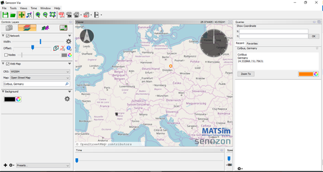
has anyone worked with the Cottbus Scenario? I am trying to use VIA with the the OSM Web Map, and the Cottbus network is showing up in France instead where it is supposed to be in eastern Germany.
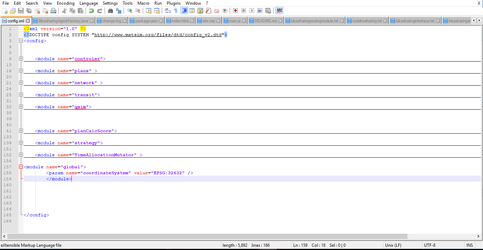
I tried adding
module name="global">
<param name="coordinateSystem" value="EPSG:32633" />
</module>
to my config file. I also tried EPSG:32632 and I got the same result. The lines of the Cottbus nework showed up in France no matter what.
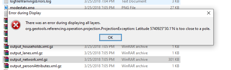
Every time I have loaded the output_network.xml.gz file so far, I get the following error message from VIA:
"There was an error during displaying all layers.
org.geotools.referencing.operation.projection.ProjectionException: Latitude 5740925 30.1' N is too close to a pole."
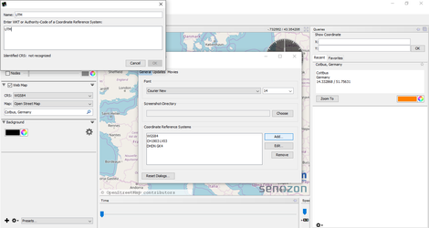
I tried adding a UTM coordinate system to VIA in the "Preferences" Window, but VIA does not recognize UTM or EPSG as a coordinate system.
My background is in civil engineering and transportation planning. My java is basic and Eclipse and GiT Hub are very confusing to me since I am learning how they work as I go. I am currently working on this project in the context of a class at the TU Berlin.
Is there a problem with the Cottbus scenario? Are the coordinates of the links and nodes simply incorrect? If so, is there a corrected network? If not, how would I correct it?
Thank you,
Clarissa